melbourne rail map - trains, trams and skybus
Melbourne Rail Network Map - showing all Yarra Trams routes, Metro and VLine train routes plus Skybus Airport bus routes, updated for June 2026 with the new MetroTunnel and half price fares from June to December 2026, and now also showing the under construction Suburban Rail Loop East.
Find out more ⤑
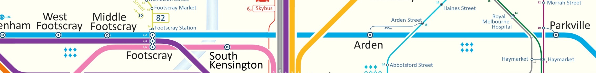
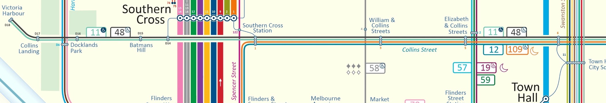
Melbourne has an impressively large suburban train network with sixteen lines serving 225 stations. The city is famously also home to the largest electric street tram network in the world with 24 routes serving 1,632 tram stops.
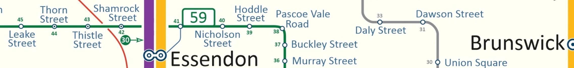
Trains run from seven city centre stations on lines to all points of the compass. From the City Loop stations (Flinders Street, Southern Cross, Flagstaff, Melbourne Central and Parliament), you can catch trains on lines to Craigieburn, Upfield, South Morang, Hurstbridge, Lilydale, Belgrave, Alamein, Glen Waverley and Frankston. From Flinders Street you can catch trains to Sandringham. From Flinders Street and Southern Cross, trains depart for Williamstown, Laverton, Werribee and when special event trains are running, to Showgrounds and/or Flemington Racecourse. From the MetroTunnel stations of Town Hall and State Library you can catch trains to Sunbury and Watergardens in the west and East Pakenham and Cranbourne in the south.
Trains on all lines generally run between 10 and 20 minutes apart on all lines from early morning to mid evening then less frequently until about midnight. Trains run all through the night on Friday and Saturday nights. The one major exception is the Flemington Racecourse line on which trains run only on days when major events are scheduled at Flemington Racecourse or at the Showgrounds.
Trams run on 24 routes (or more depending how you count them) right across the inner and middle suburbs, although they are less common in the western suburbs. As with trains, trams run from early morning to midnight, 7 days per week, and SOME lines (marked on our map with a crescent moon symbol) run all through the night on Friday and Saturday nights.
Melbournes multi-modal transport smartcard is myki. Buy a myki from any station or vending machines at major city tram stops, top it with pre-paid value using cash or card, then touch on whenever you board a tram or enter a station, and touch off whenever you leave a station.
A free tram zome covers the central city area. When travelling on any tram and your entire journey is in this area, you journey is free and you do not need any myki. Tram stops in the Free Tram Zone are marked on our map with green ticks.
Australian Rail Maps © 1996-2026